Chicama: a wave seen from a plane
Compiled by Surf Haunts · Updated 2026-10-20
Chicama is the surf destination beside Puerto Malabrigo, a fishing port on the dry coast of La Libertad in northern Peru, where left-breaking lines can run along a long Pacific bay when the conditions align.
A name from a map
The story of how surfers found it has been told by the people involved. In 1965 the Hawaiian surfer Chuck Shipman saw surf through the window of a commercial airliner and looked for the biggest name on his map; it was "Chicama", which he later learned was the name of a valley some way to the south. He saw the lines again on two more flights in 1965 and 1966, but the expeditions sent to find them failed: there were no highway signs, and the only shore roads ran through sugar fields that kept being moved.
The beach was found by car. The Peruvian surfer Carlos "Flaco" Barreda and five friends set out from Lima in a Citroën 2CV and a VW Beetle, worked out from the timing of Shipman's sighting that the wave lay between Chimbote and Chiclayo, and checked the beaches northward. Near Paiján, locals pointed them to a nearby beach called Puerto Malabrigo. The name from the map stuck anyway. We do not give a year for the car expedition; the account that comes from Shipman and Barreda themselves does not.
The first wave protected by law
Peru is the country that wrote surf breaks into law. The regulation of the Ley de Rompientes was published in 2013, and protection requires a technical file submitted to DICAPI, the harbour-masters' directorate. The first file took more than two years of work, carried by the campaign HAZla por tu Ola with the surfing federation FENTA and the group Conservamos por Naturaleza, and in 2016 a resolution registered and protected the break named Rompiente de Chicama – the first in Peru. Puerto Malabrigo itself is listed today in the district of Rázuri, and the environment ministry has recognised the beach for its coastal management. The 2016 resolution uses a different district label; we leave the two records side by side rather than reconcile them.
What we don't claim
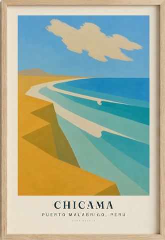
No length, no record, no "longest". Official sources agree on Chicama's importance and disagree on its measurements, so the print paints repeated lines along a bay, not a distance.
Do you know the port?
If you fished from Puerto Malabrigo, or surfed Chicama in the decades before the law, email us. We'll ask before publishing anything and agree how to credit you.
Our Chicama print
Our Chicama print follows ochre desert planes along the bay while three pale wave bands travel through turquoise and deep blue; two small hooks mark the direction of the breaking water, and the town and pier are left out.
Compiled from public historical sources and fact-checked against them at the time of writing – not a first-hand or local account. Corrections and memories are welcome; we verify before publishing anything sent in.